|

|
|

|

|
|
|
|
|
|
|
|
|
|
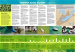
This FREE poster unpacks the history and science behind Lake Erie's now-annual algal bloom. Learn why Lake Erie experiences so many harmful algal blooms and how scientists are using innovative tools to understand and hopefully prevent these blooms in the future. Complete with a timeline of milestones in the fight against blooms in Lake Erie, this 39" x 27" poster is a useful guide for offices or high school and college classrooms.
|
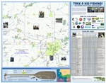
Use this guide to get started on your next fishing adventure in the Mid-Michigan area. The map shows fishing access sites on local lakes and streams, and the fish illustrations on the reverse side of the map help identify many of the common fish species found in these bodies of water. Other information includes the do's and don'ts of living or recreating near water, and tips for preparing and eating the fish you catch.
View and download this FREE interactive PDF here. Note you do not need to add this to your cart - just download the PDF via the link.
|
Michigan Sea Grant is empowering paddlers to protect the waters they love through the MI Paddle Stewards program. Use these outreach materials to spread the word about the program so that people can learn to identify and report invasive species as well as how to easily decontaminate their paddleboat. These are free, but must be ordered in quantities of either 30 or 60.
|

|

|

|
|

|
|
|
|
|
|
|
|
|
|
|
Michigan Sea Grant is empowering paddlers to protect the waters they love through the MI Paddle Stewards program. Use these outreach materials to spread the word about the program so that people can learn to identify and report invasive species as well as how to easily decontaminate their paddleboat. These are free, but must be ordered in quantities of either 30 or 60.
|
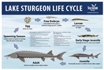
This educational poster celebrates the lake sturgeon, a native Great Lakes species with important ties to Michigan's Indigenous communities.
|
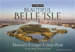
Take a self-guided tour of Belle Isle with this 24-page, water-resistant, wire-bound flip book (7.25"x5"). Belle Isle Park is located in the Detroit River, which flows between the United States and Canada. As you bike, paddle, drive, or walk around Belle Isle, learn about the history and features of this beautiful state park at your own pace. Historical photographs give a glimpse into the island's past, and the accompanying text gives a bite-sized taste of how this 1.5-square mile park came to be.
|

|
|

|
|

|

|
|
|
|
|
|
|
|
|
|
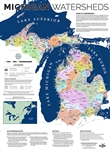
Perfect for the classroom! The 2021 updated Michigan Watersheds Map is a fantastic way to illustrate a personal connection to the waters of the Great Lakes.
|
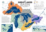
This map, showcasing the Great Lakes Basin, demonstrates just how large the lakes and their drainages are.
|
Show your appreciation for fresh fish with this high-quality apron! Available in beige or navy, the "Fresh Fish, So Delish" apron is made from a blend of 55% certified organic cotton and 45% recycled polyester with two front pockets, brass rivets, and adjustable cotton ties. Made in a SEDEX SMETA audited facility. One size fits most. Apron body width: 20"; Length: 30-1/4"
|

|

|

|

|

|

|
|
|
|
|
|
Celebrate Michigan's pleasant peninsulas with a "Surrounded by Greatness" hooded sweatshirt. Available in Thunder Bay Blue or Grand Traverse Green, and in sizes from S-2XL.
Product description from Comfort Colors: This garment is made from 80% ring spun USA cotton and 20% polyester, offering durability and comfort. Preshrunk and soft-washed, it ensures a comfortable fit from the first wear. The fabric is garment-dyed, adding depth to the color. It is made with 80% sustainably and fairly grown USA cotton and sewn with USA cotton thread, reflecting a commitment to ethical sourcing. The lined hood features a matching drawcord for added convenience. Additionally, it features side-seamed body with double-needle stitching for durability, a pouch pocket for storage, and a relaxed waistband for a comfortable fit. Comfort Colors utilizes 50% less water than traditional pigment processes on pigment color blast garments, contributing to environmental sustainability.
|

|